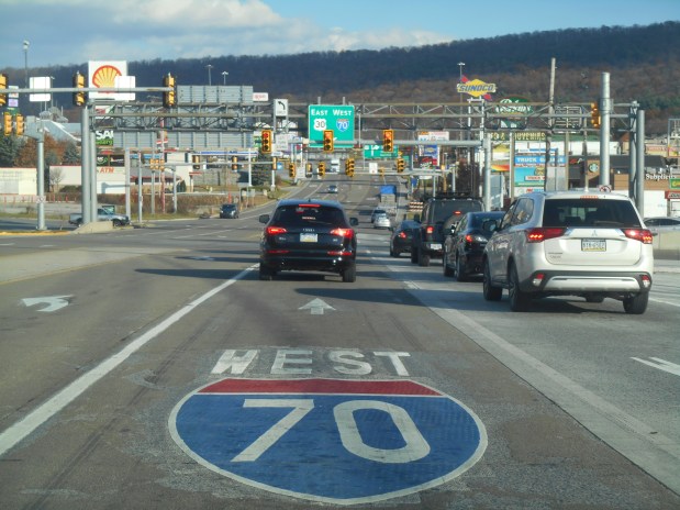
If you ever want to get one of those definitive telephoto pictures of American car culture run amok, there are few places better to trip the shutter than Breezewood, Pennsylvania. Located in the southern central part of the Keystone State, it’s a notorious “choke point” where Interstate 70, the Pennsylvania Turnpike (I-76) and the historic Lincoln Highway (Rte. 30) all meet, sort of.
Breezewood, where the Interstate is also a street.
Because of some arcane law that once proclaimed I-70 could not directly connect to the tolled Turnpike, the Interstate shares a one-mile connector with Rte. 30. This corridor is a densely packed jumble of gas station/convenience stores, fast food joints, chain hotels—all announcing themselves with signs that can reach up to about 70 feet high. There are also two truck washes and plenty of room to park your rig after tear-assing your way thru the six-lane main drag, which seems to be a local sport.
Yes, it’s all very uber-American in a way. There may be no better a democratic leveler than the free breakfast room at the Holiday Inn Express or being in line behind a couple of hunters at Sheetz, the ubiquitous convenience store/coffee shop round these parts. But just beyond the narrow limits of unincorporated Breezewood, it’s a different story. My hotel room had a view of a picturesque farm. And if you head due east, you’ll be driving down the historic and scenic Lincoln Highway as soon as you clear the hill at the end of the strip.
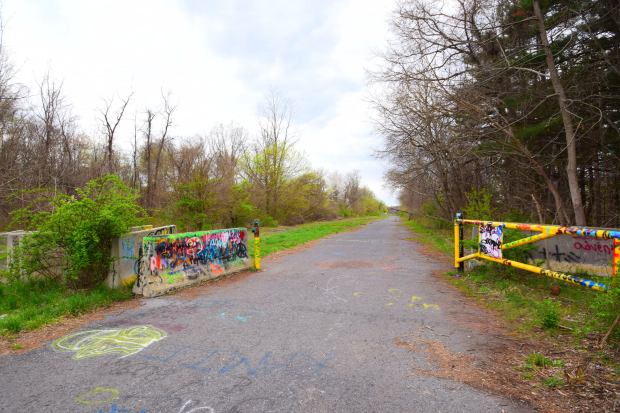
But just before you do, there’s a rutted dirt parking lot next to a paved path you can walk up on. If you do, you’ll be entering one of the state’s strangest and most intriguing points of interest, the Abandoned Pennsylvania Turnpike.
Surrender all hope ye who enter….
The Turnpike opened in 1940 and was an engineering marvel at the time, and a precursor to the massive American Interstate system that followed. But by 1968, car culture had long expanded and so had the Pike, except for this 13-mile stretch. It was logistically too difficult to widen it here and was re-routed. It is now an accessible (but unmaintained and unmonitored) public walking and biking trail.
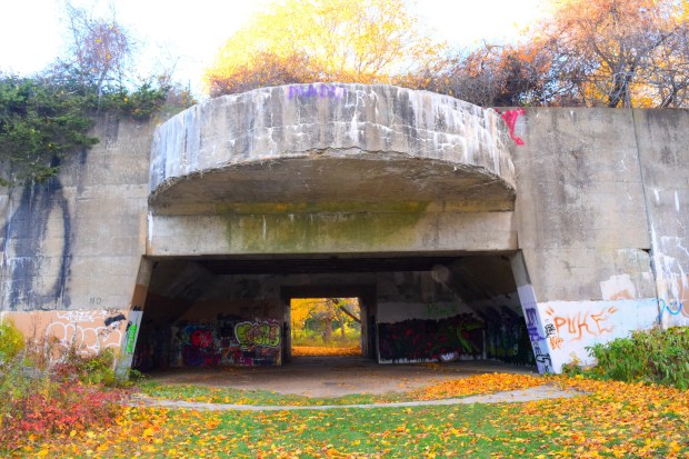
As a devoted (but not hardcore) member of the urban exploring subculture, I had long wanted to visit the APT. I got my first chance a few springtimes ago. I was on foot, and it was almost two miles from the Breezewood parking area to the first of the two tunnels on the trail. The way to Ray’s Hill Tunnel is a bit eerie, and evocative of an age of simpler automobiles and slower driving speeds. It presents as four rather narrow lanes but drops down to two at the tunnel. It was cool to see one of the turnpike’s original scalloped tunnels, not matter how defaced it is with graffiti.
Along with the taggers, curiosity-seekers and photographers, the APT has attracted at least one major film production. The 2009 screen adaptation of the Cormac McCarthy novel “The Road” takes place in the wake of an undefined extinction event (Apocalypse How?) and has many scenes filmed there.
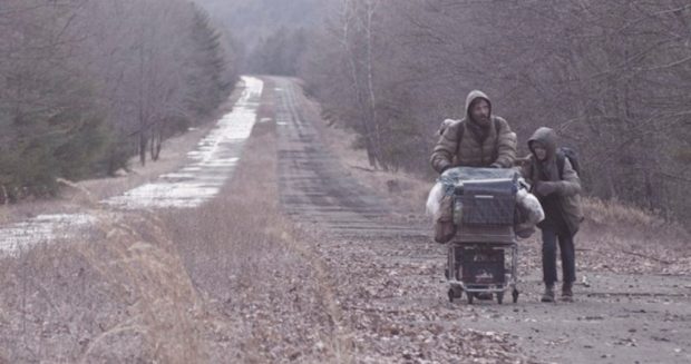
Vito Mortensen and Kodi Smit-McPhee in “The Road.”
It’s curious how highways are such ideal settings for post-apocalypse movies. “The Road” does not feature the fiendishly modified vehicles tearing down outback highways like in the “Mad Max/Road Warrior” series. Things are even worse here, and a key scene is the confrontation between Vito’s protagonist and a wandering member of a violent cannibal gang when the group’s ragtag truck stalls out after emerging from the grim interior of Ray’s Hill Tunnel.
On my second visit to Abandoned Pennsylvania Turnpike last fall, I had my new foldable Zizzo Bike and was ready to explore a bigger chunk of the ruined roadway. After pedaling past the strollers and the Goth kids doing Instagram pics at the mouth of the forbidding tunnel, I sailed thru the underpass with a big assist from a nifty little head lamp I bought for the occasion. On the other side, the atmosphere became more desolate in a hurry.
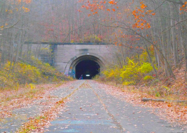
The far end of Ray’s Hill Tunnel.
Surely, not as desolate as the scenario in “The Road,” where the populace seems divided between killer cannibal gangs and those who retain the minimum standards of civilization, hoping to reach a promised safe haven once they follow the bleak highway all the way to the coast. Still, it is interesting to note that central Pennsylvania is on a sort of political fault line. The more liberal (blue) eastern part of the state can stand in stark contrast to the western hinterlands, where people have been warned to not even have a Joe Biden bumper sticker on their car to guard against reprisals from a hard-core MAGA constituency.
In the book “Divided Highways: Building the Interstate Highways, Transforming American Life,” author Tom Lewis details the passing of the massive legislation that authorized this epic road-building program was initiated by Republican President Dwight Eisenhower and eventually approved by a Democratic-controlled Congress—in an election year, no less! A transcontinental public-benefitting triumph that would “bind the nation.” It would hard to imagine an accomplishment (or agreement) like that with the toxically divided Washington of today.
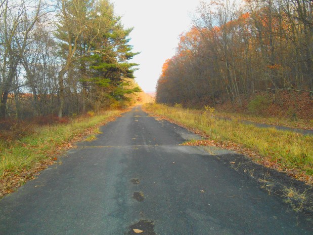
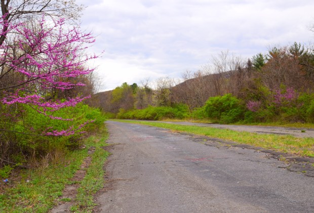
It was twilight time as I reached the lonely halfway section of the APT (see above), and with little time to make the whole route before dark, I turned the Zizzo back towards the parking lot. Riding into the gloaming is enough to make you conjure your own dystopia—the kind where cars are all but obsolete and the world is hard under the heel of ecocide and/or a disastrous civil conflict.
The next morning I was in the better disposition as I checked out of the Holiday Inn, and said good-bye for now to Breezewood, the Las Vegas of service areas. I hope I can get back again to bike the whole ghostly trail. I topped the hill and drove into the immediate rural area on the Lincoln Highway, the road that kicked off America’s Highway Century (it opened in 1913). But that vague dystopic notion from the twilight of the previous day reentered my head when I thought of the next stop on my road trip: the Gettysburg national park.
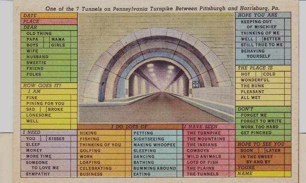
Text and all photos by Rick Ouellette, except “The Road” film still and the circa 1940 postcard.