Abandon in Place

Placeology #2: Twilight of the Road Gods

If you ever want to get one of those definitive telephoto pictures of American car culture run amok, there are few places better to trip the shutter than Breezewood, Pennsylvania. Located in the southern central part of the Keystone State, it’s a notorious “choke point” where Interstate 70, the Pennsylvania Turnpike (I-76) and the historic Lincoln Highway (Rte. 30) all meet, sort of.

Breezewood, where the Interstate is also a street.

Because of some arcane law that once proclaimed I-70 could not directly connect to the tolled Turnpike, the Interstate shares a one-mile connector with Rte. 30. This corridor is a densely packed jumble of gas station/convenience stores, fast food joints, chain hotels—all announcing themselves with signs that can reach up to about 70 feet high. There are also two truck washes and plenty of room to park your rig after tear-assing your way thru the six-lane main drag, which seems to be a local sport.

Yes, it’s all very uber-American in a way. There may be no better a democratic leveler than the free breakfast room at the Holiday Inn Express or being in line behind a couple of hunters at Sheetz, the ubiquitous convenience store/coffee shop round these parts. But just beyond the narrow limits of unincorporated Breezewood, it’s a different story. My hotel room had a view of a picturesque farm. And if you head due east, you’ll be driving down the historic and scenic Lincoln Highway as soon as you clear the hill at the end of the strip.

But just before you do, there’s a rutted dirt parking lot next to a paved path you can walk up on. If you do, you’ll be entering one of the state’s strangest and most intriguing points of interest, the Abandoned Pennsylvania Turnpike.

Surrender all hope ye who enter….

The Turnpike opened in 1940 and was an engineering marvel at the time, and a precursor to the massive American Interstate system that followed. But by 1968, car culture had long expanded and so had the Pike, except for this 13-mile stretch. It was logistically too difficult to widen it here and was re-routed. It is now an accessible (but unmaintained and unmonitored) public walking and biking trail.

As a devoted (but not hardcore) member of the urban exploring subculture, I had long wanted to visit the APT. I got my first chance a few springtimes ago. I was on foot, and it was almost two miles from the Breezewood parking area to the first of the two tunnels on the trail. The way to Ray’s Hill Tunnel is a bit eerie, and evocative of an age of simpler automobiles and slower driving speeds. It presents as four rather narrow lanes but drops down to two at the tunnel. It was cool to see one of the turnpike’s original scalloped tunnels, not matter how defaced it is with graffiti.

Along with the taggers, curiosity-seekers and photographers, the APT has attracted at least one major film production. The 2009 screen adaptation of the Cormac McCarthy novel “The Road” takes place in the wake of an undefined extinction event (Apocalypse How?) and has many scenes filmed there.

Vito Mortensen and Kodi Smit-McPhee in “The Road.”

It’s curious how highways are such ideal settings for post-apocalypse movies. “The Road” does not feature the fiendishly modified vehicles tearing down outback highways like in the “Mad Max/Road Warrior” series. Things are even worse here, and a key scene is the confrontation between Vito’s protagonist and a wandering member of a violent cannibal gang when the group’s ragtag truck stalls out after emerging from the grim interior of Ray’s Hill Tunnel.

On my second visit to Abandoned Pennsylvania Turnpike last fall, I had my new foldable Zizzo Bike and was ready to explore a bigger chunk of the ruined roadway. After pedaling past the strollers and the Goth kids doing Instagram pics at the mouth of the forbidding tunnel, I sailed thru the underpass with a big assist from a nifty little head lamp I bought for the occasion. On the other side, the atmosphere became more desolate in a hurry.

The far end of Ray’s Hill Tunnel.

Surely, not as desolate as the scenario in “The Road,” where the populace seems divided between killer cannibal gangs and those who retain the minimum standards of civilization, hoping to reach a promised safe haven once they follow the bleak highway all the way to the coast. Still, it is interesting to note that central Pennsylvania is on a sort of political fault line. The more liberal (blue) eastern part of the state can stand in stark contrast to the western hinterlands, where people have been warned to not even have a Joe Biden bumper sticker on their car to guard against reprisals from a hard-core MAGA constituency.

In the book “Divided Highways: Building the Interstate Highways, Transforming American Life,” author Tom Lewis details the passing of the massive legislation that authorized this epic road-building program was initiated by Republican President Dwight Eisenhower and eventually approved by a Democratic-controlled Congress—in an election year, no less! A transcontinental public-benefitting triumph that would “bind the nation.” It would hard to imagine an accomplishment (or agreement) like that with the toxically divided Washington of today.

It was twilight time as I reached the lonely halfway section of the APT (see above), and with little time to make the whole route before dark, I turned the Zizzo back towards the parking lot. Riding into the gloaming is enough to make you conjure your own dystopia—the kind where cars are all but obsolete and the world is hard under the heel of ecocide and/or a disastrous civil conflict.

The next morning I was in the better disposition as I checked out of the Holiday Inn, and said good-bye for now to Breezewood, the Las Vegas of service areas. I hope I can get back again to bike the whole ghostly trail. I topped the hill and drove into the immediate rural area on the Lincoln Highway, the road that kicked off America’s Highway Century (it opened in 1913). But that vague dystopic notion from the twilight of the previous day reentered my head when I thought of the next stop on my road trip: the Gettysburg national park.

Text and all photos by Rick Ouellette, except “The Road” film still and the circa 1940 postcard.

The Calliope Crashed to the Ground: Whatever Happened to the Asbury Park Casino?

Text and above photo by Rick Ouellette

Opened in 1929 and designed by the same architects who conceived of Grand Central station in New York (Whitney Warren and Charles Wetmore), the Asbury Park Casino was a monumental Beaux Arts complex that spread out over both sides of the boardwalk in what was then one of New Jersey’s premier oceanside resorts. Behind its ornamental limestone and concrete façade was a concert hall, a cinema, and indoor ice-skating rink, arcades, restaurants, and even year-round accommodations.

In the antique postcard world, the complex looked the very ideal of City Beautiful movement.

The Casino (so defined here as a place of entertainment, not gambling) anchored the southern end of the Asbury beachfront. The northern end featured another immense structure that straddled the boardwalk: the equally grand Convention Center and Paramount Theater. In between were all sorts of amusements, rides, and eateries. Asbury Park along with other similarly structured cities on the Jersey Shore, had their heyday in the simpler times of 50 to 100+ years ago, when the living was more modest and long-distance vacation destinations far less accessible.

Boarded but unbowed. The Casino in the mid-Nineties. Photo by author.

While places like Atlantic City and Wildwood still hold forth to a greater or lesser degree, Asbury Park took a massive body blow that has been especially hard to come back from. And it wasn’t just shifting societal trends or superhighways and jumbo jets that caused this decline. Mass riots in the city that broke out on July 4th, 1970 and raged for days. When it was over, the main business avenue of the city’s African-American neighborhood burned down, most of it was never rebuilt.

Looking out at the AP boardwalk from what remains of the Casino’s portal, 2017. Photo by author.

The windswept boardwalk started looking like a ghost town, but at the same time a tightly-knit (and racially integrated) community of rock ‘n’ roll and soul musicians started making a big noise in local nightclubs like the Stone Pony and Upstage. Chief among them, of course, was a young, determined and ambitious Bruce Springsteen, who hailed from nearby Freehold. A postcard of the city would adorn the cover of his debut album, 1973’s “Greetings from Asbury Park, NJ.” Though there are no direct references to the town (there would be plenty on his next album’s standout ballad “Sandy”), there is a more subtle and symbolic allusion. In the first verse of the first song, the classic word-drunk rave-up “Blinded by the Light,” Bruce is “trippin’ the merry-go-round” between adolescence and young adulthood with a colorful cast of characters. But the background scenery is not as fresh with promise—by the end of the verse “the calliope crashed to the ground.”

The Carousel House still retains much of its exterior charm, including grotesques giving you the side-eye!

And so it would be for the Casino. The building lost favor and deteriorated, attractions closed and the painted ponies were auctioned off. On my first visit to AP in 1995, the circular Carousel House now was a games arcade, the rest of the complex was shuttered. In the back corner of the arcade, you could see what remained of the skating hall (see top photo) giving some idea of the great interior scale of the place. At that time, the beachside part of the Casino was still standing. But disinvestment and the ravages of time and tide and storms would eventually lead to demolition.

The Casino’s boardwalk passageway, then and now, Bottom photo by author.

My second visit to Asbury Park, in 2017, saw half of it gone, the walk-thru was thrashed, enlivened only by the bright and sensuous mermaid murals. The Carousel House is still the only part of it that’s open, nowadays used as an indoor skateboard park.

A renovation of what is left looks unlikely, although it is on the city’s wish list. But Asbury Park is a funny place: it seems to be in a tug-of-war between decay and rejuvenation. The town has a strong arts and LGBQT community, condos are going up, and the music scene is still a factor.

The Paramount Theater today, Convention Center in backgroud (Wikipedia photo)

At this late date it is hard to see how AP could ever sustain two large-scale complexes, especially given the lofty architectural standards of a bygone era. The Convention Center and Paramount are in good shape, a new restaurant has taken over the great old space-age Howard Johnson’s and further up the boardwalk is the wonderful Silverball Retro Arcade and the fortune-telling booth of Bruce’s late friend Madam Marie: still run by her family. So there is still plenty of life left in Asbury Park. But for the Casino, it may be a case of the bigger they come they harder they fall or, in the best case, the smaller they’ll be if ever re-habbed.

Candy Floss and Catastrophe: The Peculiar Case of West Pier

Text and above photo by Rick Ouellette

It was one of the most celebrated of the 85 pleasure piers built during England’s Victorian era. In 1870, a visiting Napoleon III called it “Britain’s finest structure.” It’s grand 1600-foot oriental profile could be regarded as the people’s answer to the nearby John Nash-designed Royal Pavilion, the exotic getaway built for the Prince Regent (the future King George IV) that had been completed about four decades earlier. In its 109 years of operation (1866-1975), Brighton, England’s West Pier was a topmost playground for everyday folk on their seaside holidays. It was one described as a “luxury liner that never left its mooring” and where the anyone could have first-class accommodations for a small entrance fee. Today, however, only a small portion of the pier’s steel superstructure rises above the chilly Channel waters off the beach. West Pier’s story is one of extremes in pleasure and and calamity.

During its century-plus in operation, the pier variously featured a huge games pavilion and a concert venue with a house orchestra, amusement park rides, slot machines, ballrooms and tea rooms, pubs, and eateries. It was also known for the sale of candy floss (cotton candy) and its signature “Brighton Rock” crystal confection. Author Graham Greene used the locale and the Brighton Rock name for the title of his totemic 1938 novel of crime and Catholicism. West Pier also serves as a backdrop for the Who’s stormy 1973 rock opera “Quadrophenia.” (The band’s earlier hit “Pinball Wizard” is sung from the point of view of a lad who loses to Tommy despite knowing every machine “from Soho down to Brighton”).

Jimmy the Mod walks in front to West Pier in the photo booklet from the Who’s 1973 “Quadrophenia” album

But in the end, West Pier was just as unlucky as it was celebrated. While the Brighton Pavilion and its sister promenade Palace Pier, remain popular local landmarks, the West Pier couldn’t sustain it’s boast of being “the best pier.” Much of its central decking was removed in 1944 to prevent enemy landings. Its popularity declined in the post-war era, and more downscale amusements superseded the grand concert hall and the fashionable boardwalk deck. Structural decay commenced with dis-investment and the pierhead was closed in 1970. Maintenance costs for such an ambitious structure scared away potential new owners and the whole place was off limits five years later.

In 1994, West Pier flounders while Palace Pier flourishes. Photos by author.

West Pier became a sort of plebeian version of the old romantic ruined castle. The 1982 book “Dead Tech: A Guide to the Archaeology of Tomorrow,” by photographer Manfred Hamm and writer Rolf Steinberg was in the vanguard of an aesthetic that would spur the urban exploration phenomenon. It featured several sad but alluring photos of West Pier, placing it in the same obsolescent class as a graveyard for old steam-powered trains and the abandoned launching pads of the Apollo space program. It attracted trespassers and vandals and by 1994, when I visited Brighton the foot of the pier had been cut off from the land in an attempt (ultimately unsuccessful) to stop further damage.

West Pier sun deck by “Dead Tech” photographer Manfred Hamm

This beached leviathan was destined for a series of indignities that would all but wipe it off the map while other English piers from Blackpool down to Southend-on-Sea would continue to thrive. The cyclonic Great Storm of 1987 caused a partial collapse. Another severe weather event in 2002 caused the concert hall to cave in. Two major fires delivered the knockout punch in 2003. Both were considered of suspicious origin; I would love to hear any story of how arsonists accomplished this wicked feat, considering the pier was cut off from land and only accessible from structurally unsound steel supports.

The first of the 2003 fires. Photo by Mark Harris

Even in the skeletal shell form it was reduced to, West Pier continues to fascinate. It’s been used for a giant laser light show and the 2003 fires are re-lived in singer Nick Cave’s novel “The Death of Bunny Munro.” Most notably for me, the fictional 1970 collapse of West Pier is the basis of writer Mark Haddon’s astonishing lead story in his 2016 collection “The Pier Falls.” In remarkably precise, present-tense detail, Haddon creates an immense, harrowing and heartbreaking disaster out of thin air, after four introductory paragraphs of a normal day out in Brighton. But why? Hasn’t it suffered enough? There must be an aura hanging over West Pier’s skeleton that makes it a subconscious marker of the mortality that awaits even the most powerful of persons or things. It’s that ineffable quality that makes our modern ruins so irresistible to ponder.

The cover of Mark Haddon’s book shows the pier as it looks today.
Today, the 530-foot i360 observation tower stands on the site of the old West Pier entrance. Photo by Arild Vagen

Machine Age Masterpiece: Bethlehem Steel’s Singular Second Act

The gargantuan Bethlehem Steel plant towers over the Lehigh River in its namesake city in eastern Pennsylvania. It closed in 1995 amid sweeping changes in the global economy and laid dormant after the three-year site cleanup that followed. Since 2011, the facility has been renamed Steel Stacks and forms a dramatic backdrop to a complex that includes an arts center, a cinema, a PBS station, a museum of industry, and an outdoor concert venue among other things. Some sort of adaptive re-use was almost a given: the facility is so mammoth that it defies demolition. The city has constructed a three story-high walkway, stretching out probably close to 2000 feet, where visitors can get up close and personal to this facility. Walking this trestle, dotted with wildflower plantings and well-considered historical markers, tells a useful tale of a changing America.

The term “adaptive re-use” is a little different in this case. Unlike textile manufacturing from the early Industrial Revolution, which took place in orderly brick buildings which are perfect for gutting and rehabbing, Bethlehem Steel is a monumental jumble of blast furnaces, pipelines, vents, catwalks, conveyor lifts, and smokestacks. It wasn’t constructed so much as it was necessitated. The plant’s profile changed continually from its beginnings in the 1860s, as technology evolved. Eventually, the four mammoth blast furnaces completed the plant’s final silhouette and are now illuminated with colored spotlights at night. That’s a far cry from when the noisy and smoky furnaces were going 24/7 for decades at a time. Now relegated to its status as perhaps America’s largest art object, “The Steel” (as the complex was locally called) must be remembered reverently.

Starting in the last quarter of the 19th century, steel production was the master industry of the nation and was powered by untold thousands of mostly immigrant workers. From the rails needed for America’s train-led westward expansion, to the beams that provided the frame for numerous great bridges and skyscrapers to the armaments that saw the Allies victorious in two world wars, the industry’s contribution to national greatness was huge.

But as often is the case in heavy industry, worker conditions were abysmal, esp. in the earlier years. Brutally long shifts for six or seven days a week (with only two unpaid holidays mixed in) and numerous safety hazards (500 workers died from various mishaps between 1905 and 1941) led to the turbulent union organizing efforts that is a national historic epoch in itself. While even a peacetime two-year military veteran will get a fawning “thank you for your service” nowadays, very little lip service comes the way of laborers who toiled for decades in such places as Bethlehem. As Pulitzer Prize winning journalist John Strohmeyer wrote in his book “Bethlehem in Crisis”: “it takes uncommon talent, a strong body, and a mind that knows no fear to transform piles of (raw materials) into the molten metal that is poured, rolled and pounded into the various shapes that support the mainframe of civilization.”

Bethlehem Steel workers were fully unionized by the early Forties, but the end of World War II was also the swan song of the Machine Age. It was succeeded by the Atomic Age and the Information Age, overlaid with several iterations of the Consumer Society. Although I’m not one to deny the march of time, it seems that now we are best at manufacturing clickbait, data-mining and misinformation. Still, Bethlehem presently has it better than many Rust Belt locations, with a stabilized population based on a more varied economy. Many monolithic company towns have lost half of their citizens along with most of their tax base. For instance, U.S. Steel built the city of Gary, Indiana from scratch in the early 1900s. It is dominated by the monstrous Gary Works mill which blocks out Lake Michigan. It was once the world’s largest steel plant and is still the biggest in North America, but automation and foreign competition has reduced its workforce to 3000. The company controlled the town but never cared much for building a sustainable housing stock or providing public amenities, leading to a hollowed shell of a city.

(A telling anecdote from Hardy Green’s excellent 2010 book “The Company Town” notes that during Gary’s “heyday” the city’s largest green space was the front lawn of the factory superintendent’s mansion).

South Bethlehem, where Steel Stacks is located is not without its issues: it depends partly on a large casino (which I guess is OK if you don’t gamble) and well-heeled students from the hillside campus of Lehigh University can mix uncomfortably with lingering pockets of Forgotten America. But Steel Stacks is a promising development and if you ever go there to see a concert or a movie, have a close-up look at the plant and take heed of its story, and give a thought to those who built yesterday what we take for granted today.

Photos and text by Rick Ouellette

The Road to Ruins: Visiting the Vestiges in Books and in Person

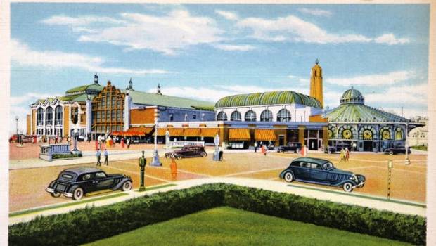
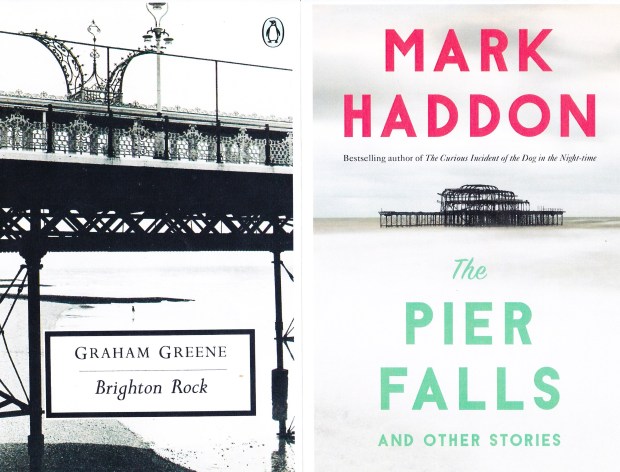
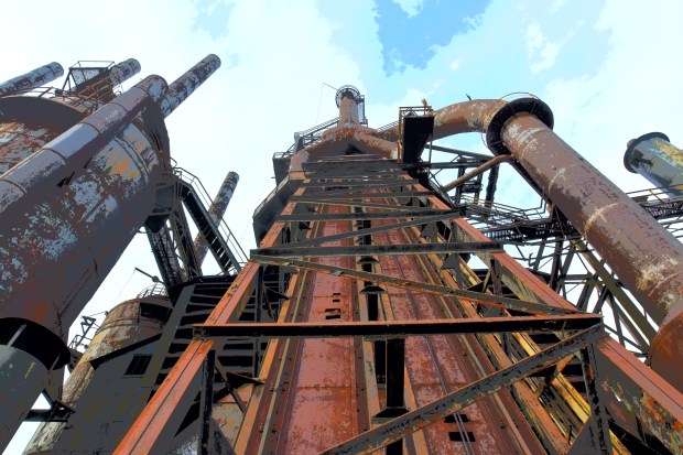
The road to ruins is paved with both the best and worst of intentions. Since time immemorial, people have either through either direct experience or artistic representation, sought communion with the relics of the man-made glories of the past. The picturesque ruins of the Roman Empire have been tourist sites of one sort or another since forever. These early antiquities give an example of the duality of their appeal. The lofty remains of temples and the Roman Forum stand for the idealism of spirituality, civic and social activity, enterprise and an advancing civilization. The nearby Colosseum, one of the world’s most recognizable ruins, is a wonder of ancient design and its building principles has been a model of stadium design ever since. But the more base appeal is the notion of all the gladiatorial battles and mass killings that went on there, often under the guise of a grim sporting event, as depicted in Hollywood spectacles on more than one occasion.


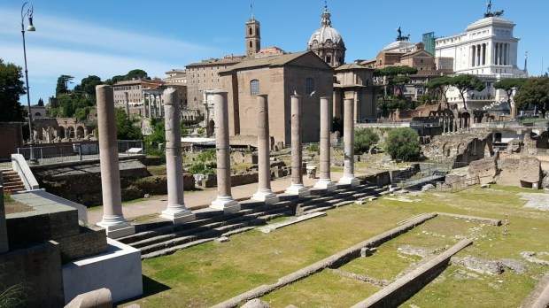
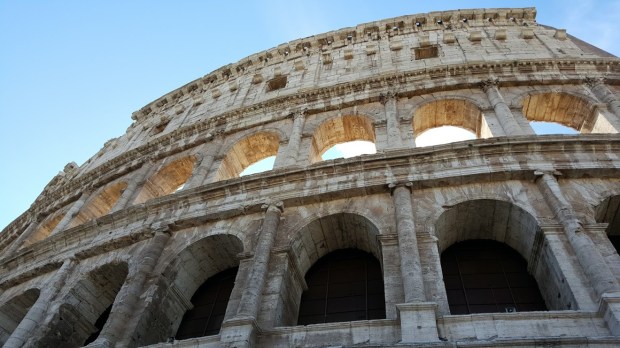
Classic ruins. The Roman Forum and Colosseum, photos by Ryan Ouellette.

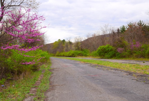
With the advent of widespread air travel in the middle of the last century, international touring grew exponentially. Combine that with the fact that the earth’s population has more than doubled in that time and it’s not hard to understand a problem that anyone who’s been anywhere famous lately has encountered: the world is being overrun by tourists. That doesn’t necessarily mean that one should skip the capitals of Europe, the Great Wall of China, the ghostly remains of Pompeii or the top of the Empire State Building—just be prepared to have lots of company. Given the dense points-of-interest overcrowding, coupled with the speed in which modern technological “progress” makes obsolete that which was recently cutting edge, it’s probably not much of a surprise that many people have gone off the beaten path to take history into their own hands.

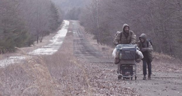
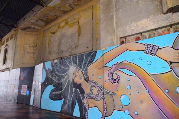
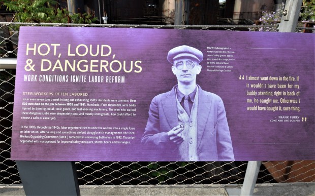
In the last couple of decades, a whole sub-culture has sprung up under the umbrella phrase “urban exploring.” In general, this brings to mind trespassing photographers and spelunkers of the boarded-up building variety. Favorite objectives included shuttered asylums, closed factories and bankrupted theme parks. The thrill of the illicit is a major factor here even if most of these photographers are sensitive to the backstory of such locations. Still, there was a time (and one not entirely in the past) where the websites of these urban explorers attracted groupie-like followers who littered the comments section with gushing praise over just how “creepy” it all is.


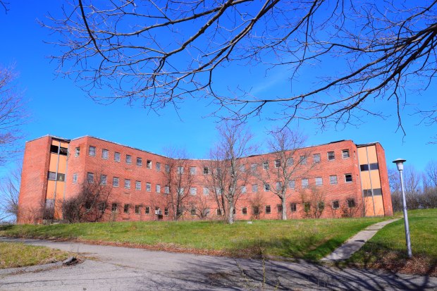
The U.S. is dotted with the remains of hundreds of closed state hospitals or, in the case of the shuttered Fernald School in Massachusetts, fearsome institutions where children with developmental issues real or greatly exaggerated, were once warehoused and even experimented on. Photo by Rick Ouellette

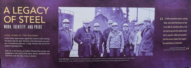
As the dogged pace of technological obsolescence has continued apace, a newer sensibility has taken place: one that strives to understand the complex social and economic reasons why such relatively new man-made achievements fall into disuse and abandonment so quickly, sometimes within a couple of generations. While the voyeuristic tendencies remain—the regrettable phrase “ruins porn” has gained traction—this soul-searching aspect is often a driving force behind the books, articles and websites on this subject.

Rubble tourism is now having its day. Instead of risking arrest, avocational photographers like myself can sign up to tour these once forbidden locations. Sometimes, the nominal purpose can be to inspire a call for landmark designation or renovation instead of demolition. I have taken workshops with two accomplished photographers who run them, sometimes together, and their books (“After the Final Curtain” by Matt Lambros and “Abandoned America” by Matthew Christopher) are reviewed below along with info about their tours. But first to begin at the beginning:

Although I’ve always been pre-disposed to notice the vestiges of a not-distant past (a trait that I have seemed to passed on to my son) this sensation never really had a name or focus for me until I saw (and bought) a copy of “Dead Tech: A Guide to the Archaeology of Tomorrow.” This book was first published in Germany in 1981 and an English version came out a year later, interestingly under the auspices of Sierra Club Books. With its enigmatic cover photo of a New York ocean liner terminal crumbling into itself on the Hudson River waterfront, “Dead Tech” had an immediate impact on me. Across nine themed chapters of evocative photographs by Manfred Hamm and historically insightful text by Rolf Steinberg, we are treated to a captivating catalogue of the recently defunct remains of world-war battlements, ships and airplanes, auto graveyards, abandoned space launch platforms, closed power plants and pleasure piers and quickly obsolete transportation systems.

The photo at the top of this post is from “Dead Tech” and shows the vestiges of the Gemini rocket launch pad in Cape Canaverel


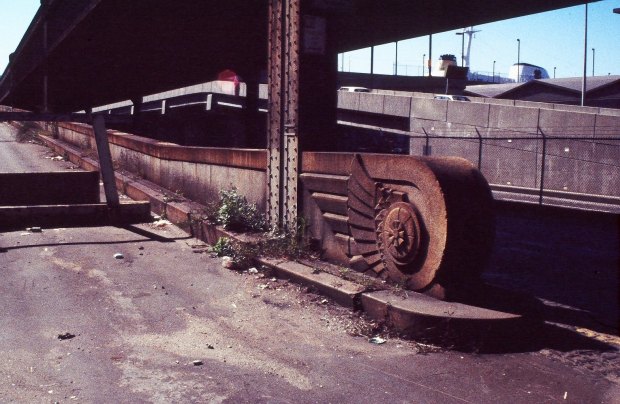
Photo by Rick Ouellette. Not long after obtaining a copy of “Dead Tech” I took to photographing similar (or the same) locations when I had the chance. One of them was Manhattan’s West Side Elevated Highway. It was one of the world’s first freeways, started in 1929. It’s well-intentioned aim was moving vehicular traffic off the surface of 11th Ave., then nicknamed “Death Avenue” because of the dangerous intermingling of autos and freight trains over 106 (!!) grade crossings. Despite the proud winged-wheel symbol seen here—–the insignia of Mercury, patron of commerce and travel—the highway was all but obsolete by the time it was completed in 1951. Interstate trucking had replaced most of the freight trains anyway and when an overloaded truck caused a section to collapse in 1973, the West Side Highway was all but done. By 1989 had been completely dismantled.

“Dead Tech’s” provocative introduction is by Austrian author Robert Jungk, described on the inner flap as an “uncomfortable futurist.” Is he ever. Jungk understood the collective existential dread of a post-war society living under the nuclear shadow, one of his main subjects. Jungk, whose surname invokes both the words “Jung” and “junk,” is no romantic when he contemplates these sites. They speak to him from a deep psychic well of historical human suffering. He writes, “Time does not only heal all wounds, it also blots out the memory of pain.” He sees the detritus of the modern world as not only wasteful but terminally short-sighted and accuses mankind of not admitting past mistakes before diving headlong into his next misadventure. This point is well taken even as you get the feeling that Robert wouldn’t be the most fun person to talk with at a party—about these ruins he says: “They are not uplifting but ludicrous and horrifying at the same time.” But their ghostly attraction is undeniable and hopefully a red flag to be heeded. (The grim stack of crushed cars piled up like a pyramid at a Philadelphia scrapyard is no one’s idea of a tourist trap). It wasn’t all gloom-and-doom with Jungk. He advocated for a new “gentle technology” and ran for president of Austria on the Green Party ticket before dying in 1994.


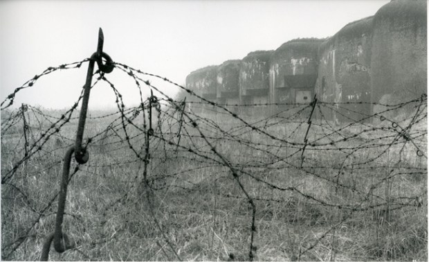
A remaining section of the Maginot Line in France. Photo by Manfred Hamm from “Dead Tech.”

********************************************************************************

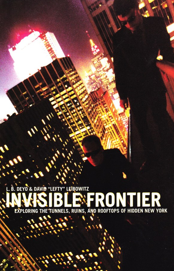
Still, the fascination continued. In the summer of 2001, a group of daring (and incongruously well-dressed) young adults set off on a series of audacious expeditions infiltrating the core of New York City’s daunting superstructure. They were led by two guys calling themselves L.B. Deyo and David “Lefty” Leibowitz, who also documented these exploits in a fascinating paperback called “Invisible Frontier.” In the admirably zany opening chapter, they attempt to traverse the Old Croton Aqueduct tunnel from an entry point in the Bronx’s Van Cortlandt Park to the Central Park area, where it used to pour its water into a giant reservoir that supplied the growing city in the second half o fthe 1800s. This would have meant crossing into Manhattan via the vertiginous High Bridge over the Harlem River. Deep collection pools, not to mention the suffocating dankness and the bats, have them eventually turning back: but not before we are treated to our first taste of the book’s curious mix of historical background and snarky banter. The “Jinx” team members dress in dark business suits—and evening dresses for the ladies—and tend to plan their missions using semi-satirical commando jargon.

Over the course of that summer the group plumbed further depths (the long-closed 1904 City Hall subway station) and then clamber up to the rooftops of Grand Central and the Tweed Courthouse, all done with cheeky aplomb (“Today we will discover a pinnacle of New York’s architectural past hidden from the prying eyes of the slovenly modern citizen”). “Invisible Frontier” culminates in a mad-dog ascent to the top of one of the George Washington Bridge towers and a six hundred feet-in-the-air epiphany. But the authors also quietly note that this off-limits triumph came a mere three days before the events of 9/11, after which a brave new world of heightened security and heightened suspicions would come into play. The Jinx group ceased their trespassing ways but its point had already been made. That despite all the building and development and now extra surveillance, “all around us lay the ruins of a golden age of style,” a half-hidden world that will live on.

********************************************************************************


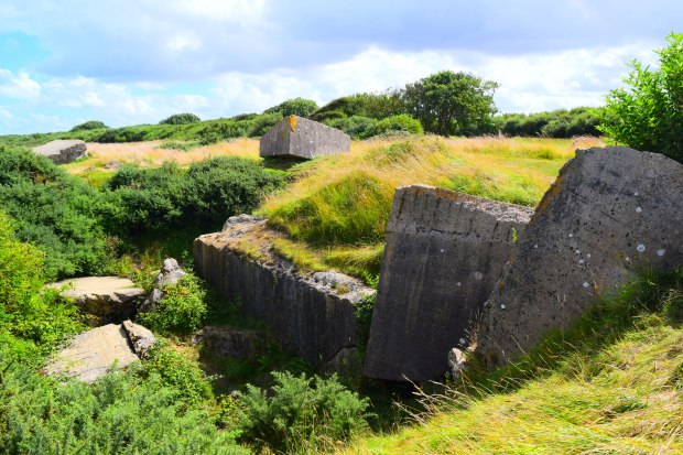
A bombed-out German bunker in Normandy. Photo by Rick Ouellette

World War Two sites, especially in Normandy, are of course enormously popular tourist destinations and have been for decades. But popular also means crowded, esp. during the summer. For the discerning war ruin devotees, the PBS series “Nazi Mega Weapons” (and by extension “WW2 Mega Weapons”) will give viewers a good look at, and the place names of, many crumbling mementoes of Adolph Hitler’s megalomania. These range from the launch pads of V-2 rockets to supposedly impregnable super-bunkers, in locations stretching from the Channel Islands to the old Eastern Front. Curiosity peaked, it’s easy in this Internet age to find even the most obscure of these sites, or to find organizations or individuals who give tours of such World War or Cold War points of interest.

********************************************************************************

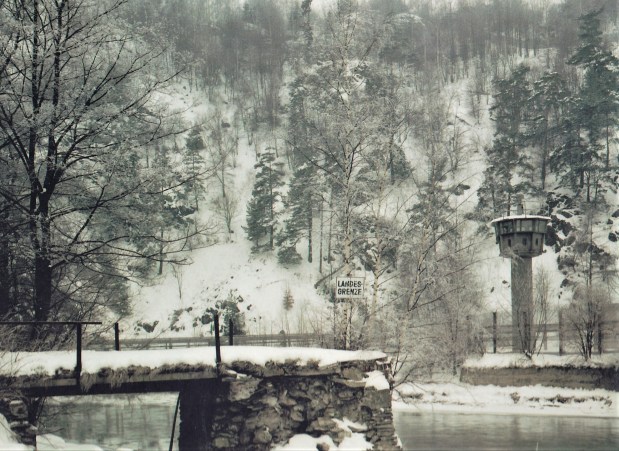
In the middle and late Eighties, American photographer Brian Rose undertook the extensive (and sometimes risky) task of documenting the vast system of walls, fences, no-man lands and guard posts that ran like a geopolitical scar separating the democratic West from the Soviet-dominated countries of Eastern Europe. The project that would result in the book “The Lost Border: The Landscape of the Iron Curtain” began when the “zero-sum logic” of this rigid ideological system—and the architecture which enforced it— was still very much in play. Just as remarkable about this artificial frontier that divided countries, towns and even streets, was the speed at which this system collapsed, as one communist state after another abdicated control after the events of late 1989.

The Iron Curtain stretched from the Black Sea to the Baltic, but Rose began his project in it’s most famous and heavily fortified section. The Berlin Wall was erected in the early 1960s to keep people from the eastern sector from escaping into the encircled enclave to the west. (Although the East German government insisted at the time that it was built to keep “fascist adventurers” from getting in). Rose’s photos deftly display both the physical and physic disconnect between two distinctly different societies sitting cheek-by-jowl. We see tourists in brightly-colored clothing peering into a grim East Berlin from a viewing stand and streets and transit lines cut off at the knee. Farther away from the cities, the border can get pretty diffuse: the fences get smaller and the borderline can be nothing but a small warning sign; one photo shows and easily stepped-over chain dividing a beach. Rose learned early on from the locals not to risk it. A few years after starting the project all this fearful apparatus became obsolete, making “The Lost Border” a valuable socio-political record over and above the high quality of his images.

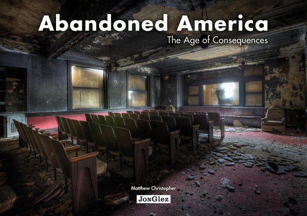
It was at the end of World War II and for the next couple of decades after that the U.S. industrial and economic might was at its peak. Of course, a lot has changed this then and never more viscerally than in photographer Matthew Christopher’s book “Abandoned America: Age of Consequences.” Page after page feature the devastated remains, in beautifully rendered hi-def photos, of buildings magnificent in scope and/or noble of purpose. These eye-popping images of derelict power plants, factories, trade schools, churches, fraternal lodges and communal vacation resorts speak powerfully of a severely shredded social and economic fabric. (Most of these locations are in Midwest and Mid-Atlantic states). These ruins say a lot of what we don’t want to hear.


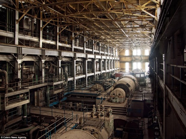
Photo by Matthew Christopher

Back from the late 19th century through to the middle of the 20th, when most of these places were constructed, there were political and social differences aplenty, often profoundly so. But there was also was a common-denominator civic pride as a baseline, not to mention a colossal industrial sector that not long ago was the envy of the world. This formed the basis for the eventual building up of a solid American middle-class and a wavering but respectable network of aid and comfort for those in legitimate need.

Not only do those “permanent achievements” look a lot less invariable by the day and it’s not just callous, cost-cutting corporations to blame. The national political dialogue (such as it is) about what to do has become the worst sort of zero-sum game. The idea that the two sides of the aisle would have a clash of ideas and each would come away with some of what they wanted is almost laughably quaint now. But there is nothing funny in the evidence of this decline seen in Christopher’s haunting images.

******************************************************************************************

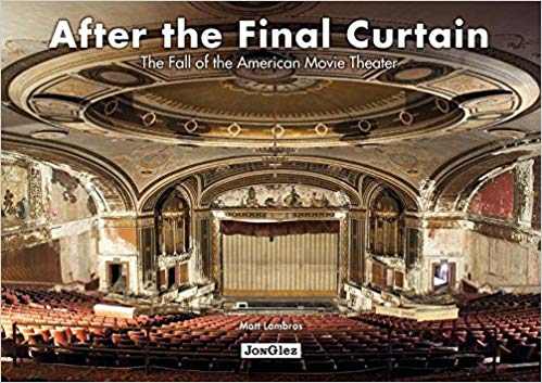
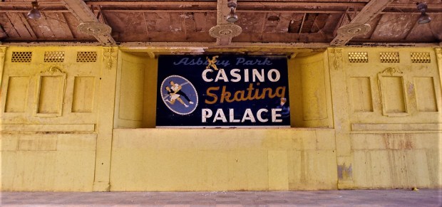
Matt Lambros had photographed close to 100 closed theaters and chose twenty of the most prominent for his sumptuous coffee table book “After the Final Curtain.” His fascination with these opulent movie palaces began with personally discovering several near where he lived in New York City. Some still open, some boarded up. Soon he was travelling the country and realizing that almost any city in America with some critical mass of population, had at least one of these places, in widely varying conditions but often the worse for wear. These places were built in the first few decades of the 20th century, when people rather expected their entertainment was to be provided in lush, classically-detailed venues and developers provided for such.

But the short and often discouraging history of these theaters can be representatively seen in the case of the stupendous Loew’s Poli Theater in Bridgeport, Connecticut (a sweeping view of which graces the book’s cover). In opened in 1922, after a two-decade period which saw the city’s population double from 70,000 to more than 140,000. Still, not a megalopolis but enough that the growing port city could support a second auditorium next door and connect it all with a hotel and shops. Over 3000 people could watch vaudeville and silent films in the main hall and it made a successful switch to the talkies. But y’all know what happens next: TV, surburbanization, the income inequality that afflicted many older downtowns. The 50-year timeline of the Loew’s Poli is not uncommon: it soldiered on into the mid-century, underwent name changes and new usages and, like many others, ended as an adult-film house before closing in the 1970s. Some of these places have been re-furbished but it’s always an extremely costly proposition and many still languish.

If you’re interested in visiting these type of places (and esp. interested in photographing them) your’re in luck. Both Matthew Christopher and Matt Lambros run workshops where you can click your cameras at places like this (sometimes the “Two Matts” run these events together). See below for their websites and more info. And wherever you go, may all your travels be “ruined.”

https://afterthefinalcurtain.net/
https://www.abandonedamerica.us/


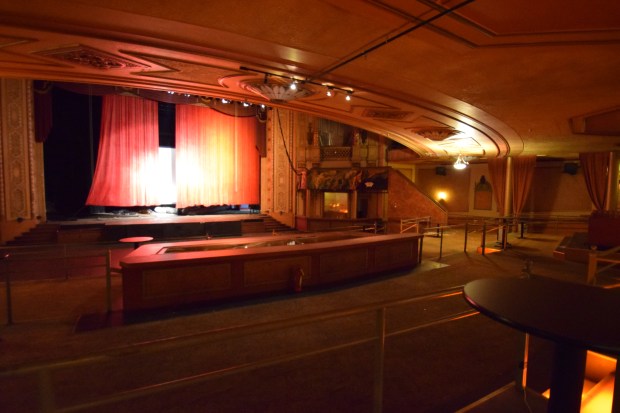
Photo by Rick Ouellette. The old Paramount Theater in Springfield, Mass. (later the Hippodrome nightclub). From a photo workshop I did with Matt lambros and Matthew Christopher.