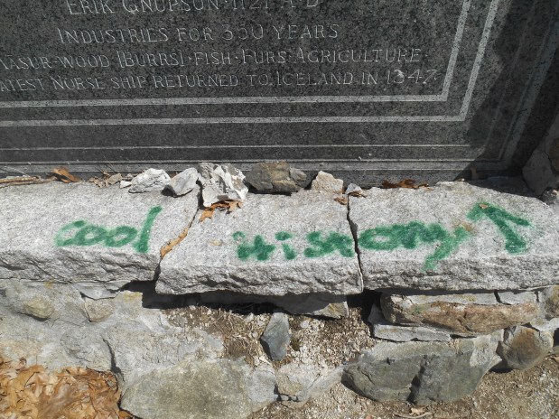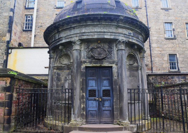
The infamous Black Mausoleum in Edinburgh, ground zero for a poltergeist that has tormented as many as 3000 people. Or perhaps not. (More below)
Do you believe in ghosts? I don’t mean situations that appear spooky, like a moonlit walk in deepest October. I certainly don’t mean taking at face value the reputation of some old mansion, hotel or castle as “being haunted.” I’m referring to an actual encounter with a paranormal entity that is not only psychologically terrifying but that may also physically attack you. How about it?
Even though there has never been any scientific proof of paranormal existence, 40-45% of Americans believe in ghosts/spirits. Are people being sold an invisible product? Sometimes it seems that ghosts were invented to sell tickets to the inconclusive ghost tours that now permeate any atmospheric tourist destination. (Not the least in Salem, Mass. my hometown.) Surely, spook stories and haunted houses are so ingrained in popular culture that it makes me seem like a spoilsport to mention it, but a recent reading experience (and various online outlets) left me very puzzled and wondering if this widespread belief in the paranormal is something worse than harmless.

Welcome to the Kirkyard
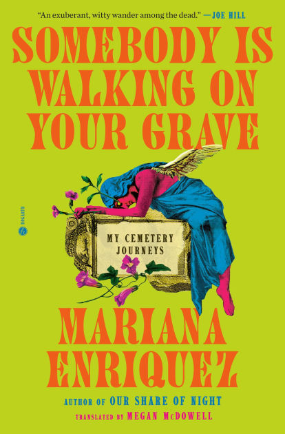
First was while reading the chapter on Edinburgh’s macabre Greyfriars Kirkyard in the book “Somebody is Walking on Your Grave: My Cemetery Journeys” by Argentine author Marina Enriquez. Funerary art, with its heady blend of the beautiful and the morbid, is a fascinating subject. Enriguez, a punk rock maven and literary goth queen, has fashioned a jaunty and well-researched survey of exceptional necropolis-type resting places in North and South America and Europe and their uncanny histories.
In her Kirkyard chapter, Enriquez recounts the story of the dreaded George “Bloody” Mackenzie, who was Scotland’s Lord Advocate in 1679 when a dissident Presbyterian group called the Covenanters were defeated in a battle by the army of King Charles II. In service to the crown, Mackenzie had the captured Covenanters interred in a field next to Kirkyard cemetery in conditions so bad that it was called the world’s first concentration camp. Hundreds died and were buried in the Kirkyard, a place (not uncommon then) that held the remains of many more people than the number of headstones would indicate. Mackenzie was eventually laid to rest in a grim memorial that became known as the Black Mausoleum, probably just steps away from many of his victims.
That bit of history is interesting enough for me. But here’s where it gets weird. In 1998, a homeless man, trying to find shelter during a cold rainy night, managed to enter Mackenzie’s crypt thru a hole in the back. The floor gave way and the poor guy fell into a pile of bones, possibly a plague pit. (OK, that’s really interesting too). After another incident, where two teenagers stole a skull from the same place and barely escaped jail under Edinburgh’s ancient grave-robbing laws, the alleged Mackenzie poltergeist really went to town.
Since then, there have been hundreds of “documented” attacks on visitors, some estimates go as high as 3000. People have supposedly fainted, suffered scratches or bruises, had their hair pulled; there’s even a claim of broken fingers and at least one heart attack. Who is “documenting” these attacks? Is it the Edinburgh police department? No, their main concern vis a vis the Kirkyard is vandalism and nighttime trespassing. When I investigated, all this documenting seems to emanate from—surprise!—ghost tour guide companies.
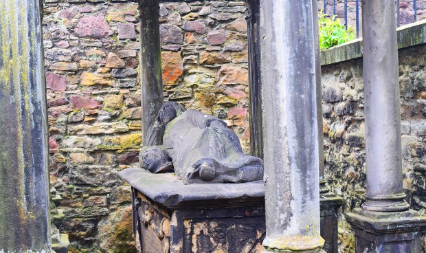
Next to Mackenzie’s crypt is another unsettling site, a relaxed recumbent figure with a severed head next to it.
There’s no doubt that the ornate, begrimed Black Mausoleum has an aura. Marina Enriquez, who seems level-headed and naturally loves graveyards, writes:
“It’s a repulsive place… It feels like a living thing. Like it’s watching, vigilant; it has an intelligence, precarious but clearly perceptible… I feel the weight of all its stories as I looked at it.”
She then goes on to quickly relate another Kirkyard haunting, experienced by a punk-rock friend of hers from Scotland. Excuse me while I do a quick eye roll. I guess I was just lucky when I photographed the Black Mausoleum without a poltergeist gouging my eyes out. But seriously, can’t the great big fabulous fictional world of ghosts be good enough for us? Is it possible to enjoy Dickens’ “Christmas Carol” without having to claim that the ghost of Jacob Marley is real? Maybe I’m overthinking it, but it seems a short leap from this passive acceptance of the supernatural to regressive magical thinking, distrust or disinterest in objective reality and the slide down into the cesspool of conspiracy theories, whose negative effect on political discourse is profound.
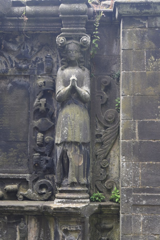
A praying statue on the other side of the wall from the Covenanters prison.
If you answered yes to the opening question, may I suggest pivoting to an interest like the esoteric field of hauntology? It concerns the residual presence of the past and its effect on present-day society—or even the essence of a promised future that is unlikely to materialize. It’s a slippery concept to be sure, but name-dropping it will be sure to impress your friends, and it even has the word “haunt” in it. There is a great big real world that stands to be understood and improved upon. It’s always better to be savvy than superstitious.
Texts and photos by Rick Ouellette