There’s a scene early on in George Romero’s 1978 zombie epic “Dawn of the Dead” where a traffic reporter and his producer/girlfriend (along with two SWAT officers) flee the apocalypse in his helicopter. Seeking refuge, they come across a large shopping mall, and figure it may be a good place to hole up—even though many of the walking dead are already ambling through the empty parking lot towards the entrance.
Baffled, the producer asks, “What are they doing, why do they come here?” Her fly-guy looks down thru aviator shades and deadpans, “A kind of instinct, memory… this was an important place in their lives.” Howls of audience laughter were all but guaranteed.
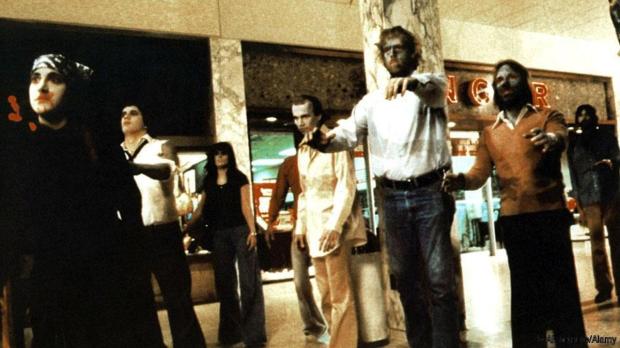
Hitting the mall, George Romero style.
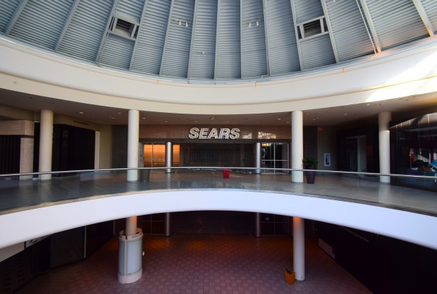
But comic relief aside, the large indoor mall was a significant place in the lives of many Americans. That is until Amazon came along. The double whammy of online shopping and the Covid pandemic caused many such shopping centers to see their vacancy rates skyrocket—making them more suitable as the setting of a ghost story than of a zombie rampage.
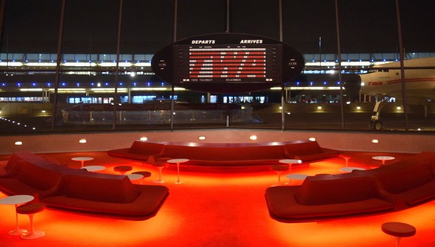
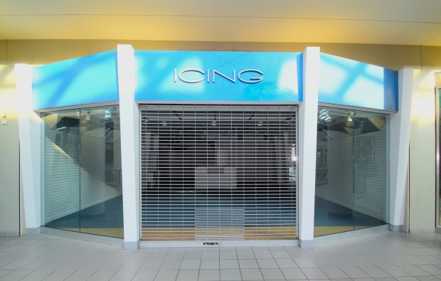
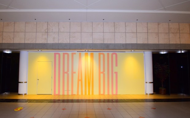
This trend has given birth to the new verb “deadmalling,” whereby urbex photographers and lovers of liminal spaces visit these forlorn victims of a fickle consumer culture. I recently hopped onto this bandwagon, visiting four struggling malls in the Boston area. (Emerald Square Mall, Liberty Tree Mall, Solomon Pond Mall and the Kingston Collection).
Since the middle of the 20th Century, these places were the engine that drove the American idea of identity-through-acquisition. But at least you had to get up and go somewhere, park and then walk to your destination store, then interact with another human being. They were also social gathering places, and many people of coming of age in those decades will fondly look back at the “mall rat” days of teenage bonding.
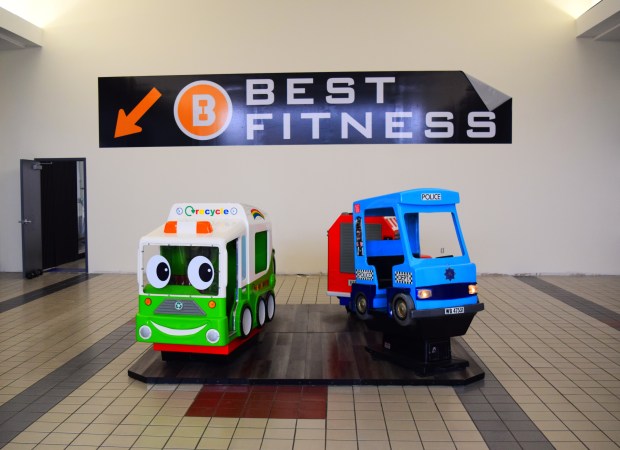
You won’t likely find roving bands of incorrigible kids roaming the corridors of dead malls. While they live it up on social media, and their parents buy “everything” on Amazon (if only I had a dollar for every time…), a mostly older clientele shuffle around and check out what stores remain or head to the multiplex cinema which always seems to be situated in the property’s deepest recess. Many are there to simply get some exercise—mall walking has long been a thing for seniors. It was a little eerie when I noticed that many don’t just walk straight down the hallways but hew to the perimeter, like they were assigned the outermost lane at a track meet.
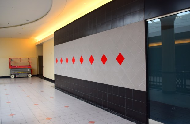
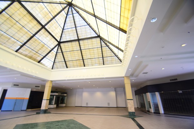
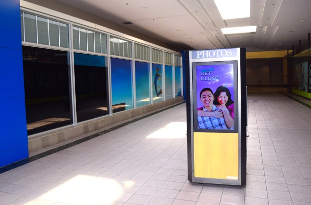
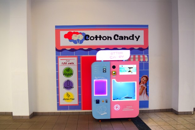
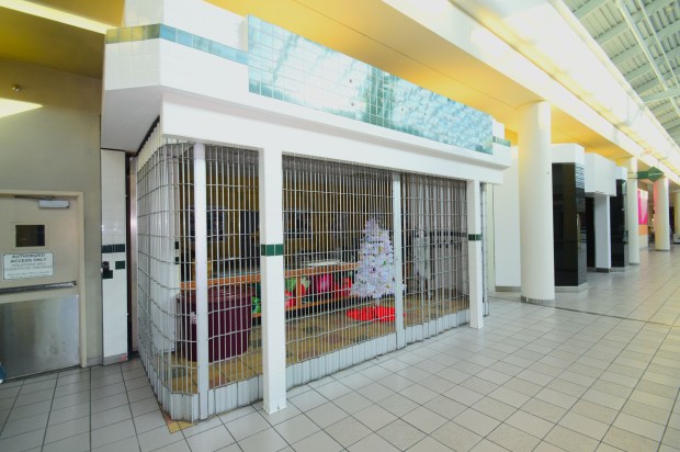
It’s all a bit unsettling, with its blank-faced side entrances, darkened food courts, former anchor-store dead ends and the isolated sitings of photo booths, massage chairs, kiddie rides and gumball machine stations. But there is also a weird, minimalist beauty to a lot of it, though I don’t believe the architects and designers ever imagined they would be appreciated this way.
While online shopping certainly has its place, its existence should not preclude previous ways of doing things, although I’m afraid that thinking through things is not currently a noticeable American trait. Amazon owner Jeff Bezos may be a very successful businessman, but he is far less successful as a human being (as anyone left at the Washington Post could tell you). His retail model has not only helped to close anchor stores but also uncountable small and middle-size businesses. Working at a mall might not be the greatest, but it beats the soul-crushing pressures of working at a cavernous Amazon warehouse, where many employees are only one rung up the ladder from bonded labor.
The malls that are surviving have opened themselves up to some smaller and/or quirkier retailers and added various events and alternate uses to help stem the tide. Some of them won’t make it and many others will likely lurch along in the strange twilight bubble they exist in now. One of them, the Monroeville Mall outside of Pittsburgh (where “Dawn of the Dead” was filmed) has recently added a museum/gift shop dedicated to “Night of the Living Dead” its (literally) ground-breaking predecessor in the original “Dead” trilogy. I’m sure the late Mr. Romero would appreciate that.
Text and photos by Rick Ouellette